WALK A: THE ROMAN ROAD
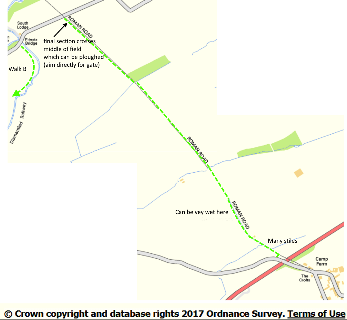
This path is waymarked throughout . The line of the Roman road from Derventio (Papcastle) to Alauna (Maryport) is self-evident on any walker’s map. This path follows that line as far as the Dovenby Craggs-Broughton road.
From the centre of Papcastle, take the road towards Broughton. Over Croft’s Bridge (crossing the Papcastle Diversion of A595 or by-pass) , a signpost to the right directs over a stile and almost immediately another to the left puts you on to the path. This is the line of the road, which initially is sunken between banks on either side and is almost invariably wet underfoot. It eventually emerges and over stiles follows the edge of two fields. As the path approaches a wood look out for the stile across the hedge on your left. The path then continues on the left side of the fence line. When it reaches a copse, stiles direct you along its eastern edge and back into another field. After a few yards the fence turns right and you are left with no guide where the path goes. Head for the field gate directly ahead – you are allowed to walk this direct line whatever crop might be growing.
Continuation: Apart from retracing your steps, which may be unexciting although the view ahead is different, turn left along the road to Priest’s Bridge; immediately over it, a footpath leaves the road to the left – this is described as Walk B