Chapter 5. Maps
Maps really did not start to appear for rural areas until the 16th century, and then only as county maps. The first complete set was by Saxton from 1574 to 1576. These tended to be small-scale, i.e. lots of miles to the inch. These maps whilst identifying communities, were very short on other detail and were not very accurate. Saxton’s map of Cumberland dated 1576, if the reproduction now available is full-size, is just under 4 miles to the inch and does not even show Papcastle. [Scale about 1:250,000]
The next development was the production of estate maps, again from about 1570 and again with Saxton himself. These provided a landowner with a detailed and more accurate visualisation of his possessions. These maps were to a much larger scale anything up to 20 inches to the mile. [1: 3000]
1763: The first map we have been able to trace is a surveyor’s map of the estate of William Hicks. This shows the estate (Westworth and Camp Farm) reasonably accurately, but unfortunately, any houses through the rest of the village seem to be schematic only. [1]
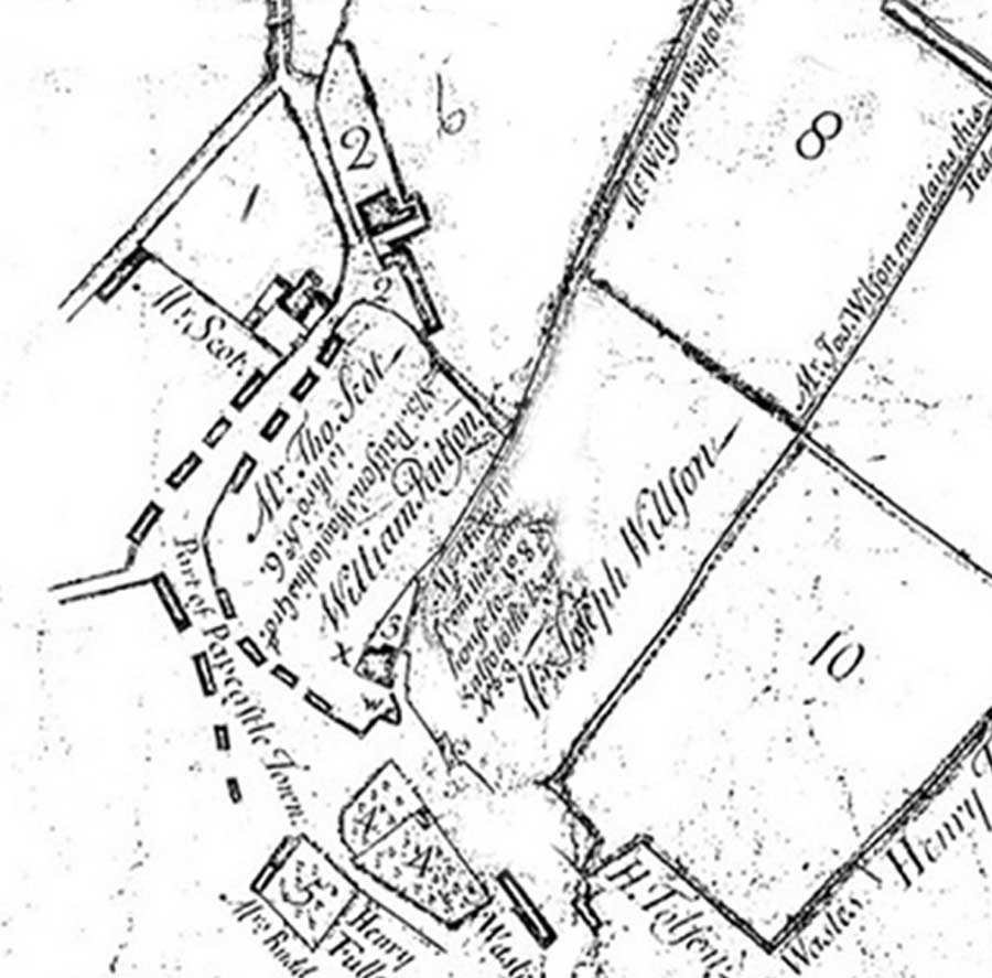
Hicks Estate Map (extract) 1763
One of the early major reasons for mapping was to control the populace. Following the 1745 Jacobite Rebellion in Scotland, Major General William Roy was dispatched to map the country in detail. He surveyed the whole of mainland Scotland at a scale of 1 inch to 1000 yards [1: 36000] His maps were used to assist the policing of the rebellious Scots for decades. The maps are still in use today as the basis of the Ancient Woodland Inventory of Scotland. Roy’s pioneering work using new theodolites and mapping techniques led directly to the establishment of the Ordnance Survey in 1791, which is now the world’s largest producer of commercial maps.
1759: The Society of Arts offered prizes for new and accurate surveys. The Society stipulated that the maps must be based on a trigonometrical survey, have accurate road distances, correct latitude and longitude, and that a scale of at least one inch to one mile be used.
1774: For Cumberland, Thomas Donald published a map on a scale of 1 inch to one mile.
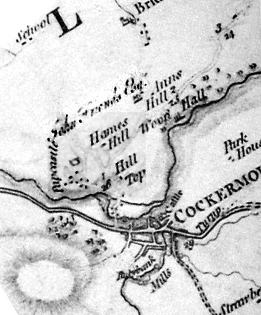
Extract from Thomas Donald’s 1774 map
This map was one of the most important steps in the mapping of Cumberland. But there was no common code of practice among many surveyors working round the country, each having a preference for different aspects of the landscape. This means that little reliance can be placed on any detail shown, such as the scatter of houses in a village or town. [2] Donald’s map shows only 9 houses in Papcastle which cannot be right. (There were more than this). Probably these are the more substantial ones, leaving out the more humble cottages, but even so one cannot match them with known properties. Unfortunately the minor roads are shown very faint on the reproduced map and are impossible to relate accurately with those of today.
An interesting feature is the road from Carlisle which follows the old route to just above what is now Hames Hall; this was presumably built on the site of the place marked Hill Top. Hames Hill (a farm?) was then much further north, about on the line of the present main road. The fact that the map legends are on the skew, derives from the fact that the top of the original was North-West, not North.
1832: On John Wood’s map of Cockermouth, there is an inset for Papcastle showing the names, presumably, of the owners of various properties. [3]
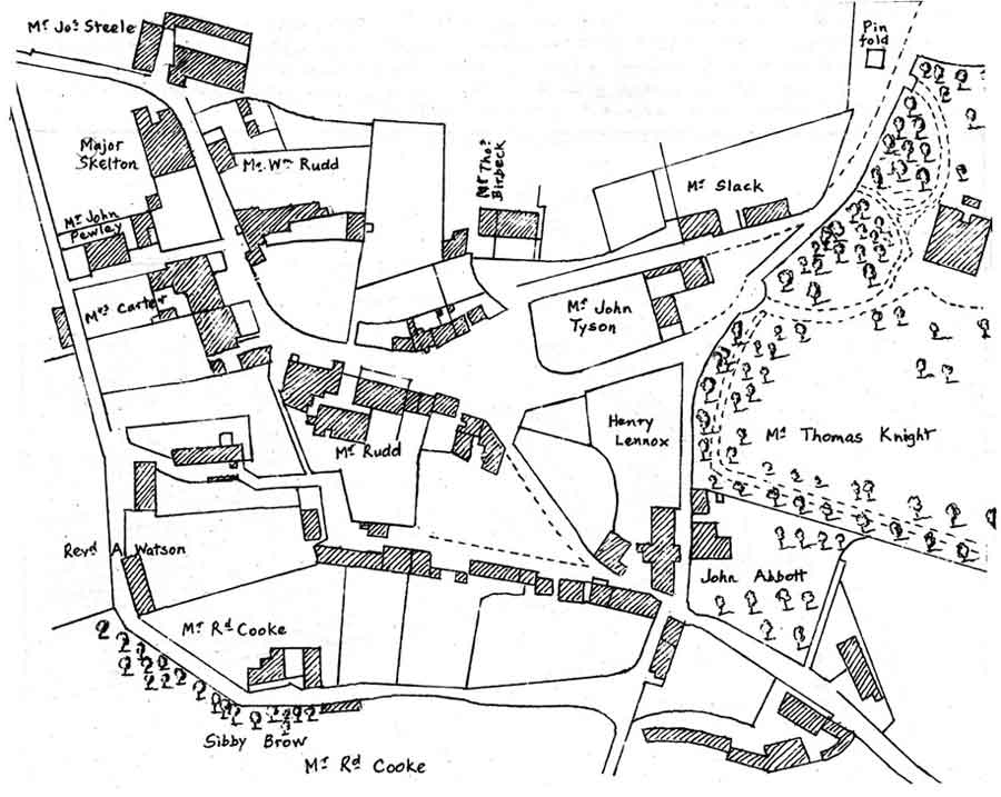
Inset from John Wood’s Map of 1832
1838: The map accompanying the Tithe Commutation Agreement shows who owned what, and the schedule cross-links this as well as indicating the occupiers. [4]
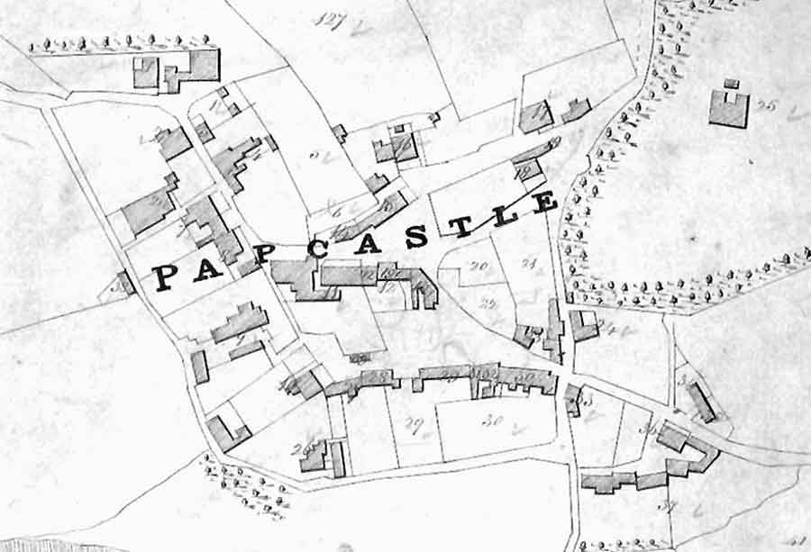
Map from the Draft Tithe Commutation Agreement 1838
Large-scale maps did not show relief well if at all. The need for this arising from the worries of the Napoleonic era, and for consistency in the county maps led to the Trigonometrical Survey (later the Ordnance Survey), starting in 1791.
The first published 1-inch map was of Kent in 1801. By 1854, the 25-inch [1:2500] survey was authorised and taken as standard. For Cumberland, this did not happen until 1863-4.
1874: So the first real map which can be relied on is the Ordnance Survey, surveyed in 1863-4 but not published until 1874. [5]. It was followed by a 1900-edition still based on this earlier survey.
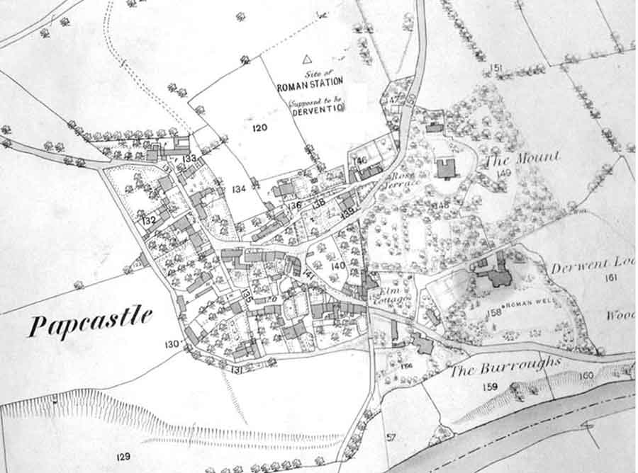
Ordnance Survey 1863-4 printed 1874
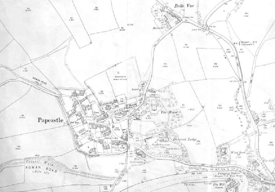
Ordnance Survey 1900